The N2 Dublin to
Derry route is a national primary road linking Dublin to Northern Ireland and
the north west of the country, passing through the towns of Slane and Ardee,
and bypassing Carrickmacross, Castleblayney and Monaghan before becoming the A5
as it passes through Northern Ireland.
In March 2007 the
Chancellor of the UK Exchequer and the Taoiseach announced a major new roads
programme that included the A5 Western Transport Corridor from Aughnacloy to
Derry (A5 WTC). This major infrastructural project aims to upgrade over 85km of
the A5 route in Northern Ireland to a dual carriageway standard. At around this
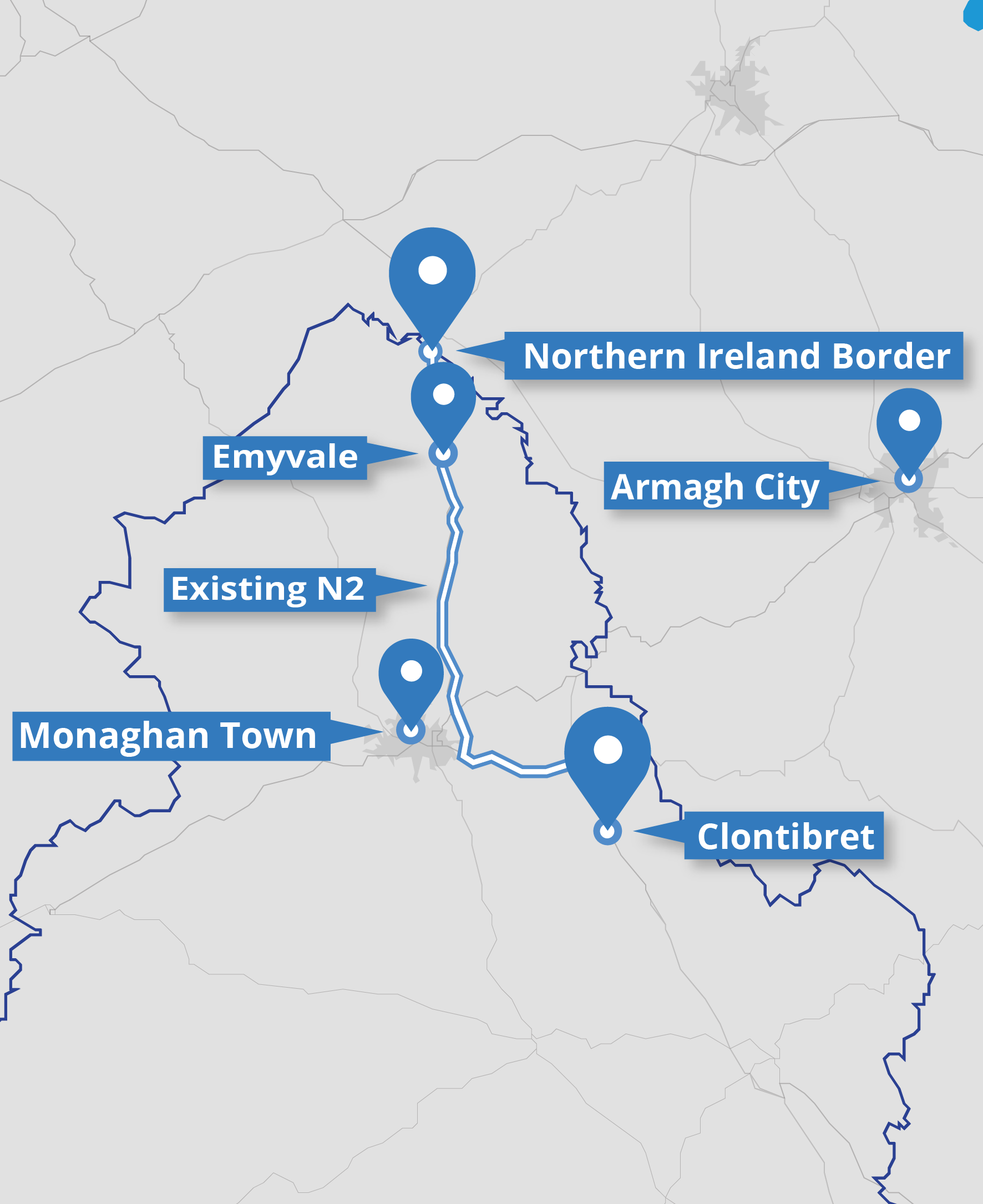
time Monaghan County Council also commenced the design process to upgrade a
section of the N2 between Clontibret and the Northern Ireland Border.
A preferred route
corridor was previously identified for the scheme in 2012 however due to the
economic downturn further progress was suspended. Funding became available
under Project Ireland 2040 to progress the planning and design of the scheme.
Due to changes in environmental legislation, design standards and to comply
with the requirements of the Public Spending Code it was be necessary to carry
out a new route selection process.
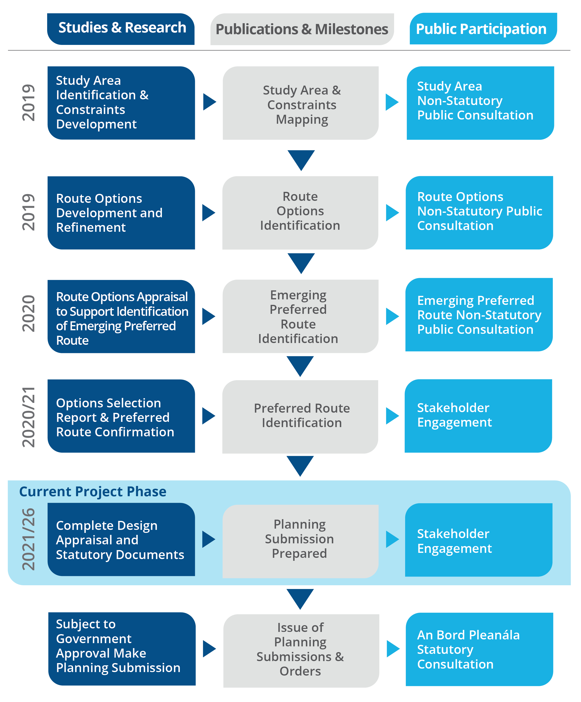
To ensure the scheme
complies with current standards and guidelines, Jacobs was required to
undertake all stages of the planning and design process, including identifying
a study area, constraints, identifying route corridor options and thereafter
selecting a Preferred Route Corridor. The Preferred Route Corridor was
published in 2021, along with an Options Selection Report. A map of the
Preferred Route Corridor is available to download here.
The Preferred Route Corridor is typically 400m wide. The corridor does
not represent the actual width of the road scheme or the lands to be acquired -
the corridor indicates the lands within which the N2 road scheme could be
developed. The Monaghan County Development Plan includes Policy NRP 7 which
will continue ‘To protect the selected route of the N2 upgrade road scheme
between Ardee and Castleblayney and the selected route between Clontibret and
the border with Northern Ireland, and to prohibit development that could
prejudice their future delivery’.
Once the Preferred
Route Corridor was identified, work commenced on the next phase of the design
process; Phase 3 – Design & Environmental Evaluation. The project was
suspended in 2022 and 2023 due to lack of funding, however thanks to EU Connecting Europe Funding, with match funding provided by the Department of
Transport through TII, the Phase 3 design process recommenced in late 2023.
For the latest information on the status
of the scheme please see the latest news section.