November 2022
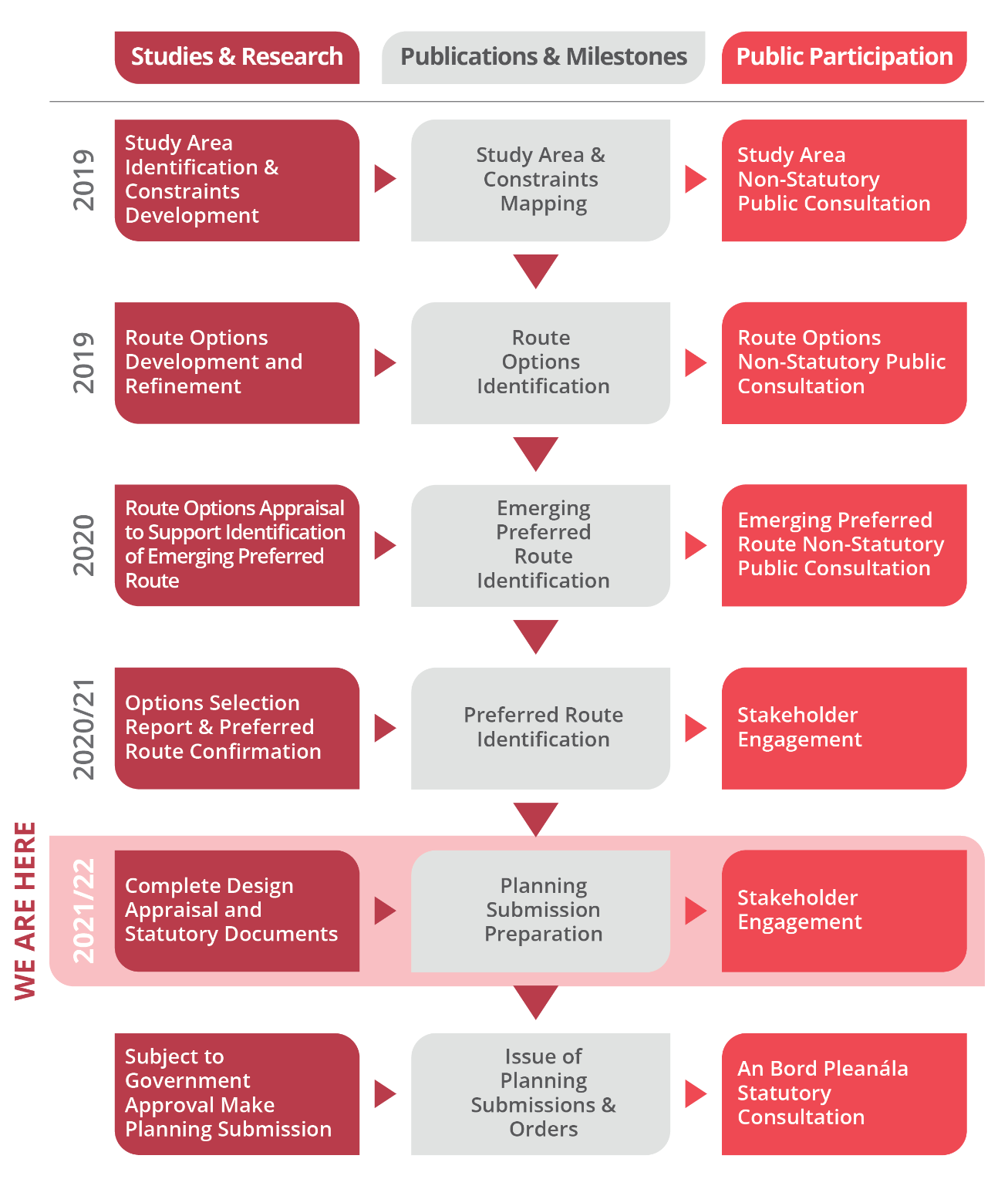
Following three public consultations
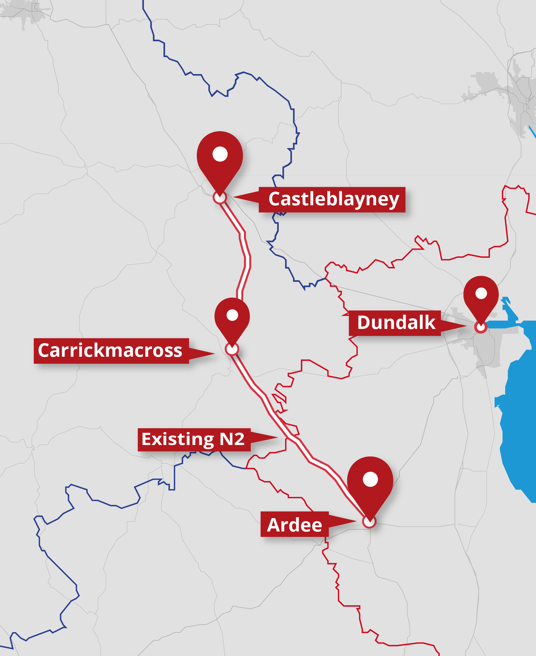
on the proposed scheme between 2019 and 2022, a 400m wide Preferred Route
Corridor was published in February 2021. The project then entered the next
phase of TII’s planning and design process (Phase 3: Design and Environmental
Evaluation) and Jacobs are in the process of designing the road (including
junctions and accesses), identifying the landtake required, and undertaking an
Environmental Impact Assessment.
By Summer 2022 the N2 Project Team
had substantially completed the necessary surveys/investigations to prepare an
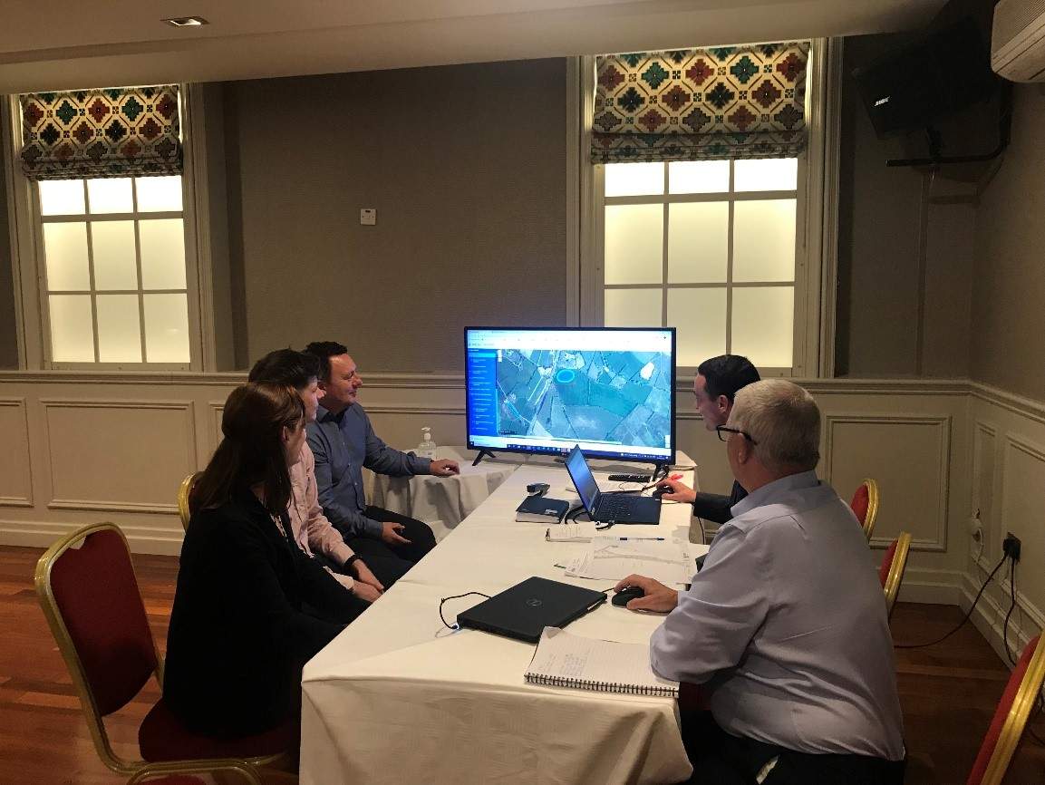
‘Initial Design’ of the proposed road. In September 2022, the project team
contacted approximately 300 directly affected landowners, inviting them to meet
with members of the project team to discuss the potential impact of the scheme
on their lands. At the landowner meetings, members of the project team provided
each landowner with an overview of the project, provided information on the
projected timeframe for completion, explained the design and impacts in the
vicinity of the landowners holding, and provided landowners with drawings of
the proposed road alignment past their property and potential landtake. The
project team wishes to sincerely thank all landowners who attended meetings for
their engagement.
After directly affected landowners
were given the opportunity to meet with the project team, the initial road design was
made available to the public. It shows the route of the proposed N2, the
locations of the proposed interchanges and junctions onto the N2, and the route
of proposed sideroads and access roads along the N2. The design is based on a
preliminary, initial design, and will be subject to change following feedback
from stakeholders.
The design has been published to allow the
wider community, stakeholders and public to view the impacts of the project on
the local road network, and to view the alternative routes they will be
required to travel to access local facilities and to join the improved N2. The
answers to Frequently Asked Questions are also available on the project
website.
Over the coming months the N2 Project Team will
consider feedback received from landowners and other stakeholders before a
design is finalised. An Environmental Impact Assessment Report and CPO
documentation will then be prepared. Subject to approval, would then be
submitted to An Bord Pleanála as part of the planning approval process.